Cycling from Kissing Camels puts world-class scenery right at your handlebars. This guide highlights the best short loops, mountain-bike systems, and longer climbs you can ride from the neighborhood’s edge, plus tips on safety, navigation, and where to refuel nearby. At the end, find a simple way to plan a neighborhood tour with us.
Quick Essentials Before You Roll
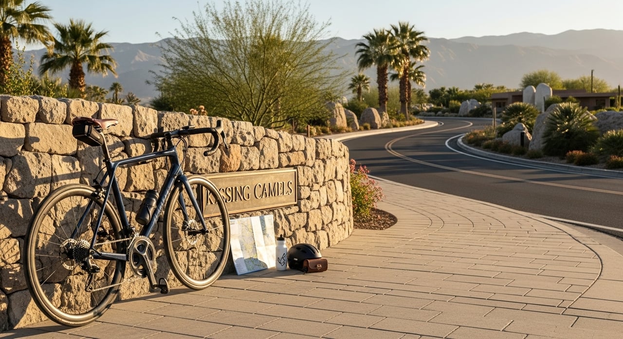
A little prep goes a long way at altitude.
- Required gear: helmet, front and rear lights, pump or CO2, spare tube, multi-tool, and a charged phone with maps.
- Bike types: road bikes shine on Garden of the Gods pavement. Hardtails or full-suspension bikes are best for Ute Valley, Red Rock Canyon, and Palmer Park singletrack. Gravel or hybrid bikes work well on the Pikes Peak Greenway. E-bikes are common on paved routes and multi-use corridors.
- Weather and elevation: Kissing Camels sits around 6,400 to 6,600 feet. Expect higher effort, stronger sun, and quick changes in temperature. Pack layers and extra water. A general rule at altitude is a drop of about 3°F per 1,000 feet of gain.
- Safety and etiquette: ride single file on narrow sections, use hand signals, yield to pedestrians on multi-use paths, and stay on designated bike-legal trails.
- Navigation tools: download a GPS route to your head unit or phone. Grab a paper map at the Garden of the Gods Visitor & Nature Center for park roads and trails.
For park details and current rules, see Garden of the Gods biking info and visitor guides at gardenofgods.com, and trail system pages for Ute Valley and Red Rock Canyon from the City of Colorado Springs.
Top Cycling Routes From Kissing Camels
Below are six local favorites that start at or just outside the neighborhood gates. Distances and times are approximate and vary by rider pace and exact route line.
Route 1: Garden of the Gods Inner Loop - Scenic and Quick
Great for a short, stunning spin with punchy climbs and wide shoulders.
- Distance and time: about 2.5 to 6 miles per loop. 15 to 35 minutes.
- Elevation and difficulty: 100 to 500 feet gain per lap. Easy to moderate with a few steep pitches.
- Surface and bike: paved park roads with marked bike lanes. Best for road, hybrid, or e-bike.
- Waypoints: Garden Drive and Juniper Way Loop, iconic rock spires, and pull-offs for photos.
- Navigation tip: ride counterclockwise for gentler grades and better sightlines. Repeat laps for a workout.
- Start and timing: roll from the Mesa Road access toward the park or begin at the Visitor & Nature Center. Early mornings are calmest.
- Seasonal notes: summer visitor traffic can be heavy. Watch for cars pulling into overlooks.
Why it works: Garden of the Gods provides dedicated bike lanes and dramatic views in a compact loop, making it ideal for quick training or a family-friendly scenic ride. For route ideas, see the Garden loop overview on The Outbound and park info at gardenofgods.com.
Sources: gardenofgods.com and theoutbound.com
Route 2: Old Colorado City - Broadmoor Connector Loop
A longer city-to-park ride that links historic neighborhoods with the Garden.
- Distance and time: roughly 15 to 26 miles, 1.5 to 3 hours.
- Elevation and difficulty: several hundred meters of total ascent. Moderate.
- Surface and bike: paved city streets and bike lanes, plus park roads. Best for road or e-bike.
- Waypoints: Old Colorado City, Broadmoor area, Garden of the Gods viewpoints.
- Navigation tip: use residential connectors to avoid busy arterials. Plan your approach to enter the park from the east for a smoother flow.
- Start and timing: begin near Kissing Camels and loop south through quieter streets before turning west. Late morning or early evening avoids peak traffic.
- Seasonal notes: variable winds in shoulder seasons; bring a light shell.
Why it works: this loop mixes steady rollers with the park’s short climbs for a complete workout. Sample route files in platforms like Bikemap show versions between 26 and 42 kilometers with 400 to 600-plus meters of ascent.
Source: bikemap.net
Route 3: Pikes Peak Highway Ascent - The Big Climb
A bucket-list effort to 14,115 feet. Only for experienced, well-prepared riders.
- Distance and time: about 12.5 miles from Crystal Reservoir to the summit. Plan several hours for the climb and descent.
- Elevation and difficulty: roughly 4,885 feet of vertical gain. Very hard.
- Surface and bike: paved highway. Road bike with low gearing recommended.
- Waypoints: Crystal Reservoir, Glen Cove, Devil’s Playground, summit house.
- Navigation tip: check highway hours and cycling rules before you go. Start early for calmer winds and safer descent timing.
- Start and timing: most riders drive to the toll gate or Crystal Reservoir, then climb. From Kissing Camels, this is a half- to full-day outing.
- Seasonal notes: rapid weather shifts and lightning risk above treeline. Expect colder temps as you gain altitude.
Why it works: the Pikes Peak Highway is a world-class climb with switchbacks and big views. Visit Colorado Springs outlines key facts, fees, and regulations for cyclists.
Source: visitcos.com
Route 4: Ute Valley Park Singletrack Sampler
Close-to-home dirt with options for every skill level.
- Distance and time: 3 to 10-plus miles in loops. 45 to 120 minutes.
- Elevation and difficulty: rolling terrain with short, punchy climbs. Easy to advanced depending on trail choice.
- Surface and bike: singletrack and multi-use dirt. Best on a hardtail or full-suspension mountain bike.
- Waypoints: Vindicator Drive trailhead, ridge views, and connecting spurs.
- Navigation tip: download a map and follow posted signs. Ride in control and yield appropriately.
- Start and timing: a short drive or ride from Kissing Camels. Mornings offer cooler temps and lighter trail traffic.
- Seasonal notes: after rain or snowmelt, expect slick spots. Avoid muddy trails to prevent damage.
Why it works: Ute Valley’s network lets you choose your challenge while staying close to home. The City’s park page highlights the trail system and riding etiquette.
Source: coloradosprings.gov
Route 5: Red Rock Canyon Open Space - Family-Friendly Loops
Scenic dirt paths with beginner options, plus fun for confident riders.
- Distance and time: 2 to 12-plus miles of marked loops. 30 to 120 minutes.
- Elevation and difficulty: gentle to moderate climbs, with a few steeper options. Easy to intermediate.
- Surface and bike: hardpack, some loose sections. Best for mountain or wide-tire hybrid.
- Waypoints: Roundup and Meadow loops, Quarry Pass, connections toward the Intemann Trail.
- Navigation tip: pick a signed loop and keep it short with kids. Bring snacks and take viewpoint breaks.
- Start and timing: park at the main Red Rock Canyon lot. Early evening light is beautiful.
- Seasonal notes: can be busy on weekends. Watch for hikers and dogs on multi-use segments.
Why it works: with more than 1,400 acres and about 40 miles of trails, Red Rock Canyon offers something for everyone, including a dedicated bike skills area and links to regional trails.
Source: cospringstrails.com
Route 6: Pikes Peak Greenway + Fountain Creek - Mixed-Surface Endurance
A low-grade path network for long, steady miles.
- Distance and time: 15 to 40-plus miles out-and-back or point-to-point. 1.5 to 4 hours.
- Elevation and difficulty: mostly flat to gentle grades. Easy to moderate.
- Surface and bike: paved and gravel multi-use paths. Best for gravel, hybrid, or e-bike.
- Waypoints: Pikes Peak Greenway segments, creekside views, and park connectors.
- Navigation tip: plan your turnaround at a trail junction or coffee stop. Keep right, announce passes.
- Start and timing: connect from the west side toward the Greenway corridor. Mid-morning avoids commuter traffic on path hotspots.
- Seasonal notes: after storms, watch for debris and standing water.
Why it works: this corridor lets you build mileage with steady pacing and minimal traffic stress, making it ideal for base fitness days and family rides.
Source: cospringstrails.com
Alternatives & Variations
- Shorten it: do one inner Garden of the Gods lap, then roll back home. Or cut a Red Rock Canyon loop to the signed beginner circuits near the main lot.
- Lengthen it: stack two Garden laps, then continue west toward Manitou Springs and return via quiet neighborhood streets. Or link Ute Valley Park with a Greenway segment for a mixed dirt-and-path day.
- E-bike adjustments: set a conservative assist level on climbs to preserve range. Use regenerative braking features where available on long descents, and plan mid-ride charging only where permitted. Stick to e-bike legal trails and multi-use paths according to posted rules.
Where to Park, Eat, and Service Your Bike Near the Start
Kissing Camels is a gated neighborhood. Please respect private roads and parking. Public-friendly starts include the Garden of the Gods Visitor & Nature Center for park road loops and city trailheads for dirt rides. Restrooms and water are available at the Visitor & Nature Center.
Coffee and bites: stop near Old Colorado City for a pre- or post-ride pastry and espresso, or grab snacks at shops along Colorado Avenue before entering the park.
Need a quick tune or rental: Criterium Bicycles is a well-known local shop for parts, service, and advice. Many area shops also rent bikes for road, gravel, and trail days.
Sources: gardenofgods.com for park info and criterium.com for local bike service.
Safety, Emergency Planning & Respecting Local Spaces
- Carry ID, a basic first-aid kit, and an emergency contact card. Store the non-emergency police number in your phone. In a true emergency, call 911.
- Report hazards like downed branches or washouts to park staff or the City’s parks department. Obey all closures and private property signs.
- Wildlife: give deer and other animals plenty of space. Control speed on blind corners and announce yourself when passing.
- Group rides: rotate single file on narrow lanes, call out road debris, and use clear hand signals for stops and turns.
For park rules and bike-specific guidance, consult Garden of the Gods resources and City of Colorado Springs park pages.
How to Choose the Right Route for Your Ride
- Time available: 30 minutes to 1 hour suggests the Garden inner loop. 1 to 2 hours fits the Greenway or Red Rock Canyon family loops. Longer blocks are great for the city-to-park loop or a Ute Valley session.
- Fitness and goals: building base miles favors the Greenway. Want intensity in a short window? Do Garden laps. Skill practice on dirt points you to Ute Valley or Red Rock Canyon.
- Bike type and surfaces: road tires excel on park pavement. 38 to 45 mm gravel tires suit mixed paths. Mountain bikes handle singletrack best.
- Weather: if winds pick up, aim for protected canyons and tree-lined paths. On hot days, start early and carry extra water. If storms threaten high country, skip alpine climbs like Pikes Peak.
Conclusion: Ride More, Live Well
Living near Kissing Camels means quick access to scenic loops, family-friendly paths, and big-mountain challenges. If you are exploring homes that fit an active lifestyle, or want a neighborhood tour that starts and ends near your favorite routes, we are here to help. Schedule a Free Consultation with The Daniels Team to learn about homes near Kissing Camels and the broader Pikes Peak region.
FAQs
- Are there bike lanes in Garden of the Gods? Yes. Park roads include marked bike lanes and wide shoulders in many sections. Check current maps at the Garden of the Gods Visitor & Nature Center.
- How steep are the Garden climbs? Short pitches can feel steep, and some approaches report grades near 15 percent. Expect quick ups and downs.
- Can I mountain bike every trail in the park? No. Only designated trails are open to bikes. Follow posted signs and maps.
- What should I know about riding Pikes Peak? You must pay admission or hold a valid pass, follow highway rules, start early, and prepare for rapid weather changes and thin air.
- Where can I find long, flat mileage? Use the Pikes Peak Greenway and Fountain Creek Regional Trail for low-grade endurance rides.
Sources for further planning:
- Garden of the Gods biking and park info: https://gardenofgods.com/activities/bike-tours/ and https://gardenofgods.com/park-info/
- Pikes Peak Highway cycling details: https://www.visitcos.com/things-to-do/pikes-peak/cycling-pikes-peak-highway/
- Ute Valley Park: https://coloradosprings.gov/parks/page/ute-valley-park
- Red Rock Canyon Open Space: https://www.cospringstrails.com/hikes/redrocks.html
- Pikes Peak Greenway and Fountain Creek: https://www.cospringstrails.com/hikes/greenway.html